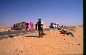
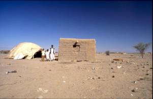
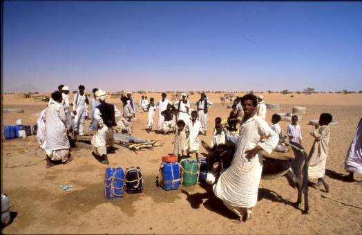
9 passengers dead in bus accident
The winter season 2004/5 did not start promising. Travelling from Cairo to Dakhla oasis on 10/18/04, the public bus (Upper Egypt Bus Company) crashed with a tourist bus (Biblische Reisen, Stuttgart), which was parking half-way on the soft shoulder (right side) of the desert highway (position N 29 39.983 + E 30 16.670). At the time of the accident our bus was travelling at maximum speed (about 130 km/h). Except for the tourist bus the road was empty. Most certainly, our driver had not payed attention to the obstacle. Instead, he probably had watched the tourists swarming out into the desert and looking for petrified wood. Because of the impact the tourist bus was turned around. Our bus skided round the obstacle and crashed onto it´s left side shortly after having left the asphalt. Nine people (including an Australian couple), sitting in the front, died. I sat at the end of the second third of the public bus and was injured at the eye and at the skull only (Later, in Germany, I had to submit to an operation of the macula.).
Bus accident 70 km on the desert road west of Cairo causing
9 deaths
I must express deep respect and gratitude to my Egyptian co-travellers and to the tourists of “Christliche Reisen”. None of the passengers paniced. The Germans (together with the Egyptians) helped the wounded and carried the deceased out of the disaster-area. Informed by satellite telephone Egyptian Red Halfmoon, a doctor and police arrived shortly after. With reference to the equipment available, the Egyptian authorities did an incredible job. However, it seems to be a wise idea not to sit in the front (or in the very back) of a bus while travelling in Egypt.
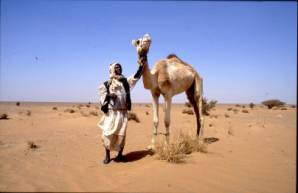
The first leg of this winter´s expedition led to the Biar Jaqub area. As the limits of this palaeoasis are still a matter of debate, the aim of the survey was to find conclusive evidence for it´s geographical extension. The journey lasted from 10/31 – 11/14/2004. I was accompanied by Christian Philipp, Hamburg, who financed the research. Chalil, my semi-bedouin friend, attended our three camels (Amur, Ashan and Mabrouka).
During the 14 day´s expedition along the western and southwestern fringes of Biar Jaqub we found a number of Claytonring-sites. They seem to queue on ancient trails connecting the palaeoasis with (so far) unknown areas in the west. The old roads have faded away over the millenia, partly covered by flat sands, partly obliterated by erosion. Backed by GPS, it was noticed that the sites were established on “lines of communication” originating from Djedefre´s Watermountain (DWM) and from a “population center” in southern Biar Jaqub. In the course of the survey the speculative nature of such “communication lines” substantiated as more and more road-signs (alamat) were found in alignment with the Claytonring depots (road-stations, resting-places?)
As shown in the case of “lost” road-segments on the Tariq Abu Ballas (TAB) void of pottery and tracks, chains of alamat are strong proof for the existence of caravan routes, which had meandered across the desert during a distant past.
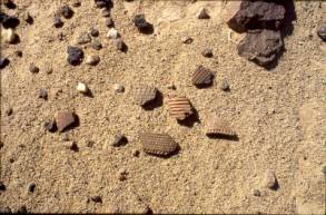
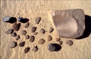
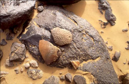
In February 1938 G.W.Murray discovered a Claytonring in the vicinity of Gebel el-Dukhan in the Eastern Desert of Egypt (see: An archaic hut in Wadi Umm Sidrah. Journal of Egyptian Archaeology 25(1939) pp. 38f.). According to pottery unearthed in association, the item was dated to the First or Second Dynasty. Objects “… of this type have not yet been found in excavations in the Nile Valley, but they have a wide distribution in the deserts east and west of the Nile”, Murray notes and suggests that the conical rings were used as “…stands for some sharp-bottomed vessels…which held the water or the milk of the family” (a doubtful proposal as it does not account for the perforated lid(?) belonging to each of these “stands”). Some Claytonrings seen on the limestone-plateau north of Dakhla-Oasis reveal potter´s wheel-marks. And a few perforated pottery discs, most probably having served as lids on the conically shaped rings, were manufactured from Roman and early Arabic period potsherds. Although such finds contribute to the notion, that the puzzling objects were also common in much later times, the First to Second Dynasty dating as well as a C-14 date (3.124 +/- 152 BC) obtained by Riemer and Kuper (Riemer, H.; Kuper, R.: “Clayton rings”: enigmatic ancient pottery in the Eastern Sahara. Sahara 12/2000, pp 91-100).) fit well into the time period during which Biar Jaqub was inhabited.
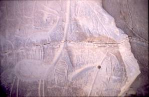
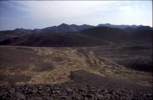
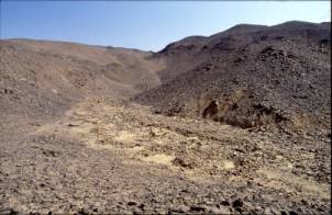
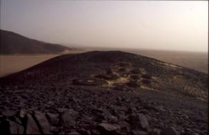
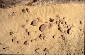
17.5 kilometres west-southwest of DWM, on a rock-face next to a tiny Claytonring deposit, a severely weathered watermountain symbol was discovered.
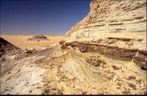
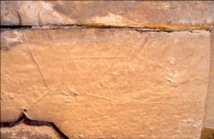
Interbedded clays, the watermountain site in the background. Weathered watermountain symbol
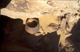
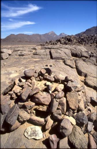
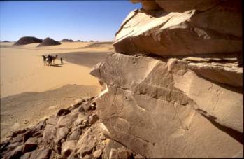
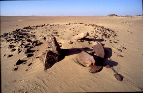
Claytonring in situ
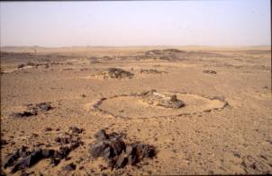
The find attests for another ancient well in the Biar Jaqub area. This watermountain-site and an area containing a number of stonecircles, found in a wide shallow hollow south of “Khufu Hills” (23.5 kilometres distance from DWM), enlarge the size of Biar Jaqub to more than 40 sqare kilometres.
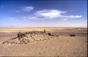
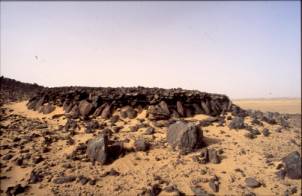
Most probably this newly discovered cluster of stonecircles accounts for a temporary ancient settlement. It´s stone-constructions bear great resemblence with those seen on the Tariq Khufu (see Report on Winter 2003/4 - Expeditions). A few of the structures contain grinding stones. Were they “kitchens”? One measures 4 metres in diameter. The height of it´s sediment-filled stone-ring could be determined by excavation. A small semi-circle, an ellbow-length in diametre, had been appended at it´s north-eastern end. Similar arrangements were found a year before at KMIN and at MAeK (ibid). To the west-southwestern end of the circle a conspicuous, 3.5 metre long line of stones (“tail”) had been attached.
Ethnological evidence collected by the author in The Sudan illustrates the purpose of such “tails”. Superimposed by a wooden construction, air-tightened by rags, such “tails” prevent lee-whirlwinds to develop and to sweep clouds of dust into the cooking area.
Ali Rasaij´s hut with “tail” in Obak/Eastern Sudan
A gap in the wall of another stonecircle spanned by a lintel reminds the observer of a door-like entrance incorporated into the structure. If this is so, it most probably was topped with a roof made out of branches or the like. In some cases such roofs might have been supported by a central pillar.
The stonecircle settlement is situated south of Khufu Hills, the last elevation of this “land of a thousand hills” (which contains the central part of Biar Jaqub) being about half a kilometre distant. To a great extent, that elevation consists of yellow colored sandstone.
According to Kuhlmann, the translator of the 4th dynasty inscriptions at DWM (Kuhlmann, K.P.: The “Oasis bypath or the issue of desert trade in pharaonic times. In: Tides of the desert. Köln 2002), the Old Kingdom expeditions of Khufu and Djedefre had come to the site (and to Biar Jaqub) in order to produce powder (mefat) from SS´-pigments(?) taken from the “desert district”. The term SS´ has not been substantiated in hieroglyphic writing. Despite of scrupulous search for ancient pigment-quarrying activities which (in a landscape where ancient relics have prevailed undisturbed over long periods of time) would remain conspicuous up to date, not the slightest indication of such works was found. Is, therefore, Kuhlmann´s interpretation of SS´ meaning “pigment” inconsistent with the findings of our investigation? Or was SS´ collected merely from the ground, thence leaving no traces of its removal? Furthermore, is SS´ really an unorganic pigment or is it of organic origin? A trial-trench at DWM has brought to light three hearths, seal impressions, potsherds of cups, bowls and storage jars characteristic of the early Old Kingdom as well as shale-tempered pottery of the Sheikh Muftah group. In one of the hearths numerous parts of locusts and even complete specimens, which had been roasted on the spot, were found. Most probably insects like these, the former having been radiocarbon dated to about 2.600 BC, were part of the daily diet of, at one time, some 400 followers of Khufu. For such purpose great amounts of locusts must have been collected in the vicinity of DWM. Do their remains attest for sufficient vegetation in Biar Jaqub; “green land”, by which the insects once were attracted? If Biar Jaqub has to be envisaged as a florishing oasis during Old Kingdom times, the probabilty of SS´ being a much esteemed organic substance should be estimated high.
An investigation of the hill in ½ kilometre distance to the stonecircle settlement revealed no traces of ancient mining operations. If, in one way or the other, SS´ was obtained from here (as a pigment incorporated in the sandstone or in layers of variegated shales fused into the rock), would it then not have made sense for the ancients to errect their settlement at the foot of the prominent landmark?
During all of the winter such considerations occupied my mind. Later, back in Germany (in early summer of 2005) Friedrich Berger and Giancarlo Negro called my attention to a press release, which reported the discovery of 4th dynasty seals and leather bags containing ferric oxide. According to inscriptions on pieces of pottery belonging to the find, the expedition, which consisted of more than 400 men, had been sent to the “desert district” in search for red paint to decorate the pyramids. The discovery was made by Egyptian archaeologists in the region of the Giza pyramids.
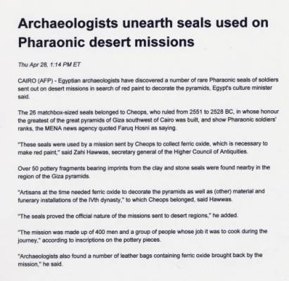
AFP-news release of 4/28/2005 reporting on discovery of
4th dynasty seals etc. at Giza pyramids
I am all on edge for the archaeological report on this discovery. If it materializes that my finds at DWM and the ones in the vicinity of the Giza pyramids are related to each other, chances are good, that the footsteps of 4th dynasty expeditions to locations deep in the Western Desert could be traced from the beginning to their end.
During the second half of the expedition further efforts were made to trace the route of the Tariq el Ma´a (TM) discovered in winter 2003/4. To our surprise, we found that the northern end of TM begins at WB-0 (13,2 kilometres southwest of DWM). WB-0 consists of two sandstone-hillocks covered with petroglyphs. It is situated at the southern fringes of a fairly round mud-pan, the latter being surrounded by a picturesqe mountain panorama. (I had discovered the site on 2/25/2001 leaving only my initials and the date of discovery on a rockface. For reasons of precise reference I later christened it WB-0.)
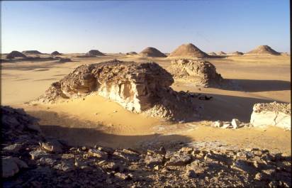
The site of WB-0
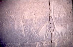
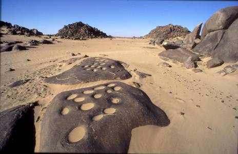
A few petroglyphs discovered at WB-0
On elevated ground almost a kilometre to the west we were able to locate a stonecircle settlement of considerable size. This site along with quite a number of grinding tools (marharkas etc.) scattered across the space between the settlement and WB-0, account for a formerly well populated area.
Concerning the route of the TM the new findings require slight modifications of my Report on Winter 2003/4 – Expeditions. Here a brief description of the trail:
From WB-0 the TM advances due south-southeast towards a solitary rock (LR) rising from the northern end of a mud pan. LR (ladies´rock), which is adorned with quite a few steatopygeous figures, was found last winter.
View from lady´s rock (LR) to the south
Departing from Khufu Hills shortly after, the trail passes by a rock-outcrop (RO+WS) situated on a high swell of open ground. In the windshade of RO+WS two stonecircles provide comfortable rest. Almost 5 kilometres to the south-southeast a group of small hills emerges from the rolling land, two of it´s elevations crowned by alamat. This is the place where, the year before, fractions of a Claytonring at the foot of an overhang had been sighted (Abri-C). Continuing south-southeasterly in almost straight line across gadually rising ground and guided by a few tiny alamat, the crest of a low, sandblown ridge is reached. From there the shallow trough of Wadi Johannes (WJ) becomes visible. Behind it rises a pyramid-shaped hill topped with alamat. It is enfiladed by two prominent elevations.
WJ is situated 28,7 kilometres south-southeast of WB-0. As reported last year, two stonecircle settlements and a rock-picture found in the wadi, give the impression, that during an unknown period of the past WJ might have been the most southern settlement of the Biar Jaqub area. Although neither a watermountain-symbol, nor remains of a water-source were found up to date (this time our search was obstructed by a sandstorm), it is most probable that WJ once was the place, where water was filled in girbas and carried to Muhattah Jaqub. If this had been the case, the donkey caravans of the Oasis Dwellers had set out from here for the 25.1 kilometre long journey to the Muhattah, the northern leg of TM therefore, merely having been a “road”, which connected the stonecircle settlements of WB-0 and WJ.
From the pyramid-shaped hill mentioned above one can see a conspicuous summit in about 20 kilometres distance on the horizon. The elevation marks Muhattah Jaqub for travellers approaching it from the north; the TAB-road station itsself (situated half a kilometre further to the south) not being perceptible because “submerged” in lowland. To strengthen the confidence of those, who travelled the TM in ancient times, stone-signals had been erected on a prominent height about 2 kilometres northwest of the Muhattah. These “signals” point like beacons towards the water-jar deposit.
17 kilometres before reaching Muhattah Jaqub one passes by a stone circle attached to a big, convex-carved piece of rock, that has fallen from a hill, the latter marked by an alam (CON-WS). The curved face of the rock functions as sound-amplifier. The effect exposed us uncomfortably to the noise of the camels rechewing their cud (The beasts were brought to rest a good hundred metres away.). 11.9 kilometres ahead of Muhattah Jaqub one arrives at MI.
From it´s beginning at WB-0 to it´s end at Muhattah Jaqub the TM measures 53,8 kilometres. However, most certainly water for replenishing the jars at Muhattah Jaqub was obtained at WJ and then carried on it for 25.1 kilometres only. Mut el-Kharab (Dakhla Oasis) is 93,3 kilometres afar from Muhattah Jaqub, a distance almost four times longer than the way to WJ. As stated in last year´s report, not only the mere length of the two road-segments compared here, but also the type of pottery found in MI and in Biar Jaqub yield sufficient evidence, that Biar Jaqub/MI had been the area, from which lateral supply of water for the Muhattah Jaqub-section of the TAB originated.
|
distance between stations |
Direction |
Total distance from WB-0 |
|
|
1. from WB-0 to LR |
4.54 km |
151 degrees |
4.54 km |
|
2. from LR to RO+WS |
8.06 km |
168 degrees |
12.6 km |
|
3. from RO+WS to Abri-C |
4.8 km |
166 degrees |
17.4 km |
|
4. from Abri-C to WJ |
11.3 km |
170 degrees |
28.7 km |
|
5. from WJ to CON-WS |
7.1 km |
163 degrees (computed) |
35.8 km |
|
6. from CON-WS to MI |
6.08 km |
163 degrees |
41.9 km |
|
7. from MI to Muhattah Jaqub |
11.9 km |
162 degrees |
53.8 km |
So far, eleven old road-segments, 22 alamat, seven stonecircles or stonecircle settlements, two pottery- and two rock-picture sites were found on the TM.
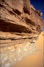
Remark on interbedded clays (IBC): Not far to the east of LR we passed a hill, it´s foot being enclosed by remains of a five metre thick stratum of playa, the latter underlayed by a band of greyish clay/loam. Up to date this is the finest example for IBC´s not only being fused into a sandstone matrix, but sealing a thick bed of fertile soil from “thirsty” sandstone strata underneath it. Only a few metres distant three marharkas and a few grinding stones were seen laying on eroded ground.
Because of the multitude and the quality of the discoveries at DWM and Biar Jaqub (including old roads connecting the area with Dakhla-Oasis and with Muhattah Jaqub on the TAB) it is most likely, that this desert-region will emerge as an important field of study for the understanding of the transition period from the Late Neolithic to the Old Kingdom era, matching in significance with Fred Wendorf´s Nabta Playa; the latter already having developed into an outstanding example for the interpretation of a cattle-pastoralist´ civilization during times when annual rainfall in the southwestern desert of Egypt became sparse.
The expedition by camel into the Eastern Desert of The Sudan (sponsored by Mr. & Mrs. Meentzen, Nordenham) lasted from 12/22/2004 to 2/14/2005. Reasons for this undertaking were
a.) to update my 1983/84 solo-camel journey into The Sudan, of which a book is in preparation
b.) to find a “reference oasis” to Biar Jaqub
c.) to survey an area in Wadi Amur.
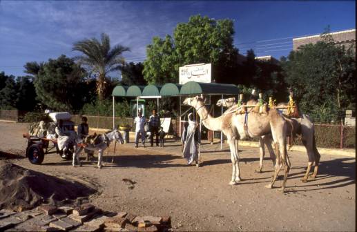
Prior to 12/22/2004 I spent more than two weeks on camel-markets in Dongola, Ed Debba, Sidon and Ed Damer in search for suitable beasts of burden.

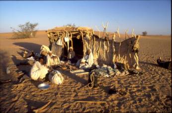
The map above (north-northwestern section of U.S. Topographical Command map, Africa 1:2 Mio., sheet Khartoum) provides insight into the route travelled. I was accompanied by Karar, an unemployed Khabir and extremely poor clansman of the Bisharin-tribe. Karar, 40 years old and a descendant of a Khabir-dynasty, had worked as caravan-leader on the Kassala-Bir Shalatein road until 2001, when more and more merchants began to utilize trucks for their shipments of camels to South-Eastern Egypt. Assessing the volatile situation in the mountain region east of the Nile, Karar´s services deemed extremly valuable for reasons of communicating with non-arabic speakers of the Beja-tribes as well as for minimizing the risk of being subjected to assaults by bandits. My Bishari escort carried only a knife for our protection. Even before walking the first step into the desert, I had (following Karar´s advice) to abandon plans to penetrate into the high mountain ranges located in the Atmaan-territory (The Atmaan or Amar´rar-Beja tribal area includes the highlands of the central section of Eastern Sudan and the coastal plain north of Port Sudan, thus their homeland being situated east of the Bisharin territory.), the latter, as I was told, being severely “contaminated” by brigants, raiders and pillagers. Despite of such precautionary measures we had enough sleepless nights. Hardly any rain had fallen during the last three years in the area we traversed, on account of which most of the goat-, sheep- and camel herdsmen had departed, leaving their land as playground to those, who are in possession of sub-machine guns. In a previous period of drought (1984/86; a major catastrophe during which, as press reports have stated, Beja-bedouins lost 95% of their herds) Karar and his brother, who then were working in the camel-transport business during wintertime while herding the family´s flock of goats and sheep during summer in the region of Sidon, Sarub, Umm Sayala, Wadi Awag Tay and Girein, had lost all their animals. Deprived of their wealth Karar, like so many others, was compelled to leave his desert home and to erect his low, hemispherical tent (made of palm-leaf mats laid over a wooden frame) in a shantytown at the fringes of Ed Damer. (On my return to Germany I succeeded in raising a small amount of aid for Karar and his family. Further donations are most welcome.)
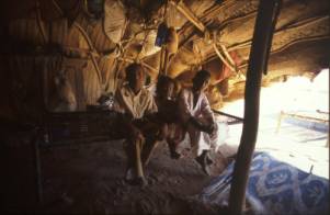
Karar´s dwelling
Inside Karar´s tent

Karar
We started from the Nile Hotel/Atbara and walked in a wide semi-circle almost up to 20 degrees latitude (area north of Jebel Ohair).
Departing from the Nile Hotel, Atbara
Our luggage was carried by two male camels (Robdan and Amur II.). Two times during the journey we were attacked by bandids and more than ten times Karar was ordered to refrain from protecting me and to let me continue on my own, so that others could murder me and take my possessions. As all these advances led to nothing, I will not include details of the molestations in the following report.
I had bought Robdan for 200.000 Dinar (around 600,- Euro). While negotiating the price, Ali Achmed, his short-term owner, told me, that the six year old camel is a stallion of fame. To me, such talking sounded like profiteering. Later however, when we met bedouins, Robdan was much in request. If there was a breeder, who wanted to barter the bull for two of his mares, there was another, who offered 400.000 Dinar and yet a third one, who proposed to pay even more. Almost everybody in the mountains knew the stallion´s story. Robdan, who was bred in the area of Gebel Robdan (Atmaan tribal territory), was given away by his master in a panic sale. The man, a poor shepherd, felt bothered by bandits. Before loosing Robdan to them, he decided to regain his tranquillity by riding the animal to the market. Robdan, exellently trained, of good character and capable to carry a heavy burden, could not be sold. To settle the requests amicably, I lent him out as consolidation for covering, here and there, a mare.
Amur II. alias Al Muharib (the warrior), a 3 ½ year old camel from the land west of the Nile, was an expensive buy (175.000 Dinar) and, actually, too young for work in our caravan. However, there was no better beast available on the market. Instead of waiting another week I had to acquiesce with him. He is such a calm animal, that his martial name had to be changed.
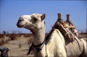
Robdan. Karar with exhausted Amur II (two days day before the end of the expedition.
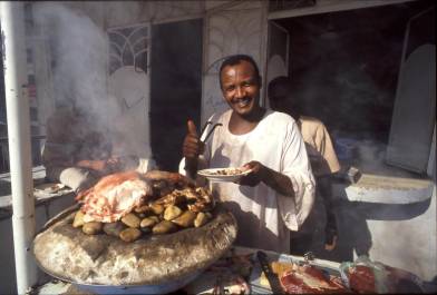
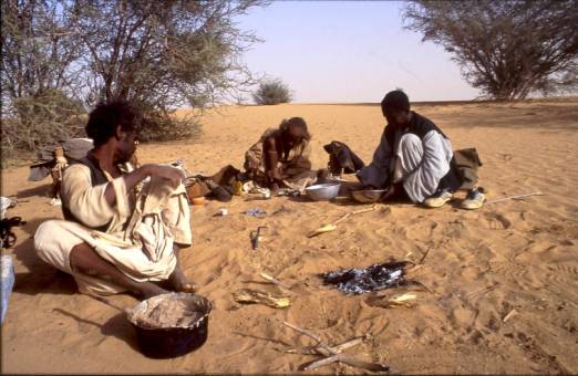
The plain, which stretches north-east of Atbara and gradually slopes upward towards the foot of the Red Sea Mountains, is covered with bone-dry soil, on top of which quite a few remains of recent cattle-herding activities (cattle-dung to be seen everywhere) and relics of those, who had farmed the land lately (remnants of fences, hafirs, potsherds, heavy granite marharkas, fragments of tools, empty cans etc.), strike the eye. We passed by a number of Steinplätze. Were they of old age? Each time when detecting one of these artefacts, Karar shouted without hesitation “Salat Lachm = (accumulation of) gravel (for roasting) meat”, thereby indicating, that the purpose of the flat, circular concentrations of heat-colored & fissured rock were absolutely familiar to him. Millions of such sites scatter the Western Desert of Egypt. Although German government sponsored prehistorians had surveyed the region and had excavated there for more than ten years, none of the experts had realized their anthropogenious nature. It took a geographer (Baldur Gabriel) to unvail the man-made character of the gravel-layouts, to extract charcoal and to date some of them (to the neolithic period). In The Sudan such neolithic food preparing practices are still common. In Atbara (and elsewhere) one can witness the roasting of meat on Steinplätzen in front of restaurants. “The meat stays clean, it is a tidy treatment; it is in accordance with Islam”, the cook assured when asked about the procedure. Comparing ethnological evidence with archaeological remains seems a worthwhile practise, as such analogizing may pave the way for a more thorough understanding of everyday life in a distant past.
Steinplatz in situ Modern Steinplatz in Atbara
On 12/27/04 we arrived at the wells of Obak. Because of the year long drought the more distant surroundings of Obak are void of vegetation. So the habitat around it´s wells covered with shrub, mimosas and acacias has mutated into the appearance of an oasis. Some of the wells have fallen dry. From a few, water is drawn at a depth of 17 metres. Looking into the shafts one notices casings of rock. The wells were drilled into a 7 metre thick stratum of playa. What kind of material underlays the playa (more playa, gravel, solid rock?) could not be learned in conversation with the inhabitants, of which about 30 have remained. “The bottom of the wells consists of impervious clays”, said Ali Rasaij, a senior resident of Obak, and continued, “I must know it. I was born here. From time to time we descend and do the cleaning.” Camels and men had assembled around the water-hole. A stiff breeze carried clouds of dust across the sky – myriads of brownish coloured granules. As if aeolean forces had combined with the thirsty soil. This spectacle led my thoughts back into Egypt´s Western Desert. What I saw here, the decay of a landscape (during a drought circle), were these not the conditions at the end of the Neolithic wetphase, when increasing aridity began to turn the regions west of the Nile into a lifeless scenery and, finally, deprived Biar Jaqub of it´s thick layers of fertile soil, into which wells (watermountain-symbols being their only remainder) had been brought down?
The wells of Obak
The wells of Obak lie east of a conspicious dune belt of considerable hight; waves of sand having swept into the woods and towards the waterholes. Adjacent to Obak is another “oasis”, Okliss, which is situated about 24 kilometres to the north. This district which, from the distance, gives the visual impression of a self contained enviroment, is inhabitated by 250 souls.
The wells of Okliss

Bedouin camp at Okliss
In Obak Karar is known as a man of exellent reputation. One of his uncles lives here with his family. We had planned to buy a goat from him. But the man had left in search for grazing ground for his animals. After watering Robdan and Amur II., we were invited by two bedouins (Sheikh Muhamed Rasaij and Muhamed Ali Rasaij) to stay in their house overnight. The “dwelling” consisted of nothing but a sandy patch in the lee of some accacias. Fire was made, coffee-beans were roasted and then pounded in a mortar. Coffee powder, sugar and water were filled into a gjebena (a small, round earthenware vessel with a slim, long neck), and, finally, the delicious brown liqid was poured into tiny cups of porcelain. This ceremony was repeated several times.
Preparing coffee and assida at Muhamed Rasaij´s dwelling
Later, Sheikh Muhamed milked a mare and spilled the warm liquid over a pot of assida (stiff porridge of sorghum flower). Night had fallen. Around us about 60 she-camels and their bleating babies. While the pauper descendants of the once powerful Bejas were occupied with the exchange of news and with story telling, I felt embraced by the archaic setting, that displayed itself around the camp-fire; the whole scene framed by the immensity and sublimity of the desert.
In the course of the conversation Karar assured himself once more of the boundaries of the Bisharin territory; vital knowledge for us, as we did not want to run into trouble by ignorance. To my surprise, a clear understanding of how to lay down the precise frontiers, existed among the men. Obviously, the times had passed, when the borders of the Bisharin habitat would be vague, and its area would extend or shrink according to their tribal numbers, and to the resisting power of their neighbours. Subsequently I learned, that because of the lack of rain most of the wells in the Sudanese section of the Bisharin land (not those in the Egyptian part of their territory) had dried up.
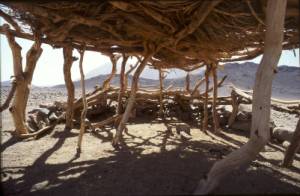
Six weeks later, on our return to Atbara, we were welcomed with the same benevolence. Then, Ali Rasaij invited us to his hut; a shelter of 2.8 x 3 m (height 1.7m), in which at the time of our visit three men, nursing two little goats, had been living comfortably during the winter season. To me it seemed illusory that the group, confined to such a small room, could ever abide in peace. However, the tranquil atmosphere and the men´s shining eyes reminded me, that inspacious living conditions mean nothing, if a dwelling, no matter how small, is surrounded by the infinity of the desert. Do the architectonic relics of ancient man (stonecircle settlements etc.), which I had seen in the Western Desert of Egypt, point to a similar quality pervading human existence?
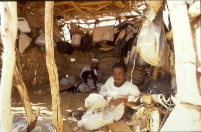
A look inside Ali Rasaij´s hut
The ethnological evidence found in Obak as well as in Okliss (which was passed on our way back to Atbara) helps to better understand the life in Biar Jaqub during late neolithic and early pharaonic times. I saw “windscreens” (low, semicircle-shaped stonewalls oriented as a “shield” towards prevailing winds), which were roofed with wooden superstructures. In some cases the roof extended the (theoretical) circumference of the (complete) circle, therefore, considerably widening the housing space. In Egypt´s Western desert such constructions (void of wooden tops) are ubiquitous. Were the wodden frames demounted by the ancients and taken to other places? Had they been destroyed by erosion? I saw remains of hunting fences and hide-outs comparable to the ones in the vicinity of Biar Jaqub. I found the same type of wheel-trap (made out of palm fibre, the sharp ends of the date-fronds used for the spikes; for details see: Murray, G.W.: Sons of Ishmael. London 1935, p.122) as the ones I had detected in the outscirts of Farafra Oasis (Egypt).
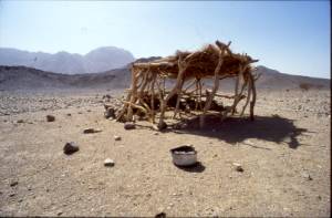
Windscreen with wooden superstructure
close-up
Remains of hunting fences
In Okliss a man in his seventies (Muhamed Sedigh Isa) led me across a formerly cultivated area, explaining that, for generations, people had planted acacias, especially Salam (acacia ehrenbergiana) and Seyaal trees (acacia sp.). Most of these plantations are gone. Only remnants of stumps and roots give reminiscence of formerly well tended small forests. Pointing to the dunes Muhamed said “All but one of those mountains of sand did not exist 50 years ago.” Vast areas are without vegetation now because of lack of rain. The mill in Okliss has closed, and flower is imported from the Nile Valley. Not long ago, the oasis exported durra to Port Sudan and to settlements along the Nile. “At least for the last ten years the rain, we desperately wait for, is falling in balat rasul = land of the prophet (Saudi Arabia)”, he closed, indicating a shift in longterm summer-monsoon pattern.
We also met flocks of donkeys unattended by men. I was told that some of these semi-wild beasts of burden habitually wander from Abadiya/Nile to the oases and back, a one-way-distance of 110 kilometres. In Egypt Biar Jaqub is only a two day´s marching distance apart from Dakhla Oasis. Is it conceivable, that some of the transport and communication between the two locations was conducted in such “low-cost style” during pharaonic times?
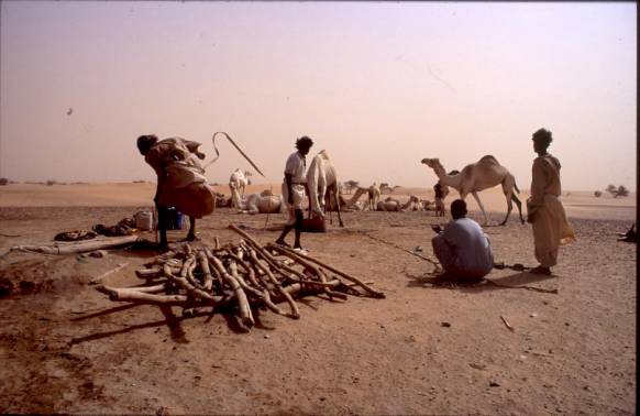
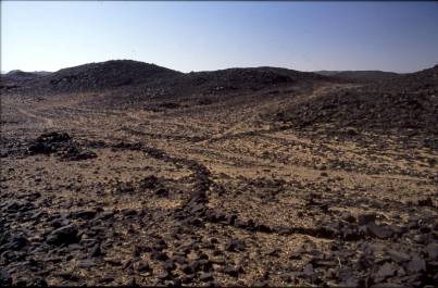
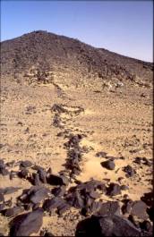
After having departed from Obak wells we approached (geologically speaking) one of the green stone-ophiolite belts, that extent across the pre-Cambrian continental carton of granite-gneiss terrain, of which most of The Sudan consists. These belts represent compressed and deformed folds of former oceanic crust and contain gold and various base metal deposits. In places where the rocks have been metamorphasized the gold has concentrated in quarz veins, the first of such geological evidence caught our eyes in the Wadi Laiamat-region. Silvery carpets of mica, glittering in the sun, quartz-pebbles and areas of scattered quartz-rock had occurred ever since the second day of the expedition, but when entering the mountain area, gray granite, seamed and stratified with vains of quartz, and large horizontal expanses of quartz on flat ground became more striking.
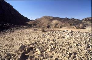

“Horizontal” expanses of weathered quartz-rock; exploited mine (Ariab) and mining
remains in background (right picture)
In almost all deposits gold is so fine-grained that it can be detected by chemical analysis only. At a few sites however, beds of the purest golden sand and the glittering of the silvery mica on granitic gravel (a sparkle, which has proved fatal to so many fortunes in California, in Brazil and in Australia), caused our caravan to slow down. After some search I found what I was curious to identify. Looking through my pocket lens, minute dots of gold and fascinating miniature-pictures of leafs of “red gold”, the latter sitting on tiny grains of quartz, evolved in front of my eyes. Does such glitter hint at rich auriferious deposits in the surrounding granit-matrix? Or is it an indication for the existence of a nugget-formation? Burton relates that the throne-stool of the king of Asiante was composed of a single nugget in quartz (Burton, R.F.: The gold-mines of Midian. New York 1995, p. 259); the biggest “gold klumpen” ever found in Arabia. We were not prepared searching for unfused gold or for any other materialization of the precious metal. I wanted photographs only. Scintillating mica catches the eye almost everywhere in the region. May it´s existence be only an allusion of nature or may it be a key to treasures of the soil, the lustrous matter led us soon to four open pit-goldmines of the bedouins. They were deserted and consisted of pits (not deeper than 1.5 metres) aligned along the upper reaches of stony wadis.
Open-pit goldmines of the bedouins
Adjacent to each mine tenements (stonecircles and -rectangles) were huddled together, none of them exeeding 2 metres in diameter (3.5 metres in lenghts respectively). Only a single rectangular shaped dwelling was topped with a wooden superstructure. Inside this room we found a gazelle-trap, a heavy pick-axe and a rababa (double-stringed viol). The largest settlement consisted of about 100 dwellings; the sheer number supporting the assumption, that, not long ago, small scale artisan gold-mining operations carried out with simple technology had represented an important source of income for local bedouin communities.

Sandfilled stonecircles as relics of bedouin dwellings
next to a small open-pit goldmine
Later I learned that the bedouins produce gold by pounding quartz in cylinder heads (mortars) of discarded water-pumps (the connecting rod of the pump being used as a pestle), then mixing the powder with water and adding “sebak” (quicksilver) to the slurry. When the resultant gold/mercury-mixture is heated up, the quicksilver separates from the precious metal and pure gold is obtained. Such procedure explains, why not a single stone-handmill for grinding quartz pebbles (as used in ancient times; see report of Agatharchides in: Diodorus Siculus III,12-14) was found at the mines.
As soon as we had entered the mountain-area, we came upon numerous graves and graveyards. The biggest of the latter ones consisted of more than 200 tumuli. Relating to the style of their superstructure, five different types of burials can be distinguished:
A.) Oblong mounds of the islamic period oriented towards Mekka (“arabische Gräber”), their top covered with white pebbles. A few of them were encircled by a ring of stones.
Two examples of arabische Gräber
B.) Conical mound-graves (“Rundhügelgräber”) of small size and unknown age.
C.) Circular mounds with a burial-place in the center (“Ringgräber”), the arrangement giving reminisce of Kerma period(?) tumuli. The biggest grave measured 12 metres in diameter. Castiglioni and Vercoutter dated a similar grave to the neolithic period, approx. 3.000-4.000 BC. (Castiglioni, A.; Vercoutter,J.: Das Goldland der Pharaonen. Mainz 1998, p. 163)

Ringgrab
D.) Circular mounds with oblong stelae incorporated into the periphery of the grave (“Stelen-Rundgräber”); the largest measuring 13 metres in diameter. Castiglinoni et al. have interpreted the position of the stelae as a place of sacrifice. Such a grave was dated to about 4.500 BC (ibid, pp. 166-169).
Stelen-Rundgrab
E.) Oblated roundgraves (“Rundscheibengräber”) up to 10 metres in diameter, their surface sometimes covered with pebbles. Similar graves were dated to 700-800 AC. (ibid, p.158)
Rundscheibengräber
About half the graves seen on this expedition were found undisturbed. Thence, there is a good chance to obtain personal belongings of the deceased as well as organic material for dating purposes from these sites. Adding such evidence to the available archaeological figures would help to fill a gap in our scanty knowledge of ancient cultural patterns, living conditions and enviromental scenarios in the Eastern Desert of The Sudan.
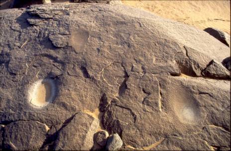
It should be mentioned here, that in the vicinity of quite a few graves old settlements were found. The largest of these sites measures 2.3 km x (at least) 0.6 km. It´s remains consist of numerous mortars sunk in rocks (“rock-marharkas”, “Reibmulden”), lower and upper grindstones, petrified bone- and ostrich-egg fragments, stonetools, Steinplätze, countless potsherds, a few pottery comb remnants (used to decorate pottery vessels) and sherds of stone vessels. Two districts of the settlement are so densely covered with sherds, that they could be labeled as “sherd-fields” (“Scherbenfelder”).
rock-marharkas
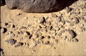
spills of decorated potsherds
spills of decorated potsherds (continued) with fragment of an ancient lower grindstone (right)
None of the sherds revealed potter´s wheel marks. Tiny mica-plates (a past-“built-in” at the time of production) glisten on the surface of some of the fragments. Obviously, bowls, jars and vessels were hand made. Does this indicate old age? The potter´s wheel was introduced from Mesoptamia into Egypt during the Old Kingdom. In Upper Nubia it was in use since Napatan and Meroitic times (see: Nordström, H.-Ä.: Pottery production. In: Sudan – Ancient treasures. Wesly, D. A.; Anderson, J. A. (ed.) London 2004, p. 251). Although it is known, that during periods of poverty the wheel-made pottery disappeared, it is (according to expert opinion from Humboldt-University, Berlin) believed, that most of the potsherds found at the above site, date to the Neolithic period (to around 5.500-6.500 BC). This is astonishing, as, at first glance, the ceramic looks much younger. Most of the sherds gather on top of undisturbed fertile ground. Taking into account increasing draughts in the Eastern Desert during the last decades, one is compelled to attribute the exellent state of potsherd preservation to effects of soil-erosion. Wind and sand have erased layers of native soil and, thereby, have unearthed the tiny prehistoric treasures. (a. Close to the dune-belt north of Obak one can study such a process in open field. - b. Hardly a day elapsed without dust-loaden whirlwinds (“usar” ) passing by – minature tornados about 200 metres high, swirling across the landscape, grinding and abrading the soil.)
At another site medieval pottery was seen at the foot of a carefully opened Rundscheibengrab.
Potsherds found at the base of a Rundscheibengrab
Remark on rock-marharkas: There can be no doubt, that the hollows sunk into horizontal streches of granite are man-made. The picture below reveals three stages of developepent of such “Reibmulden”. The one in the upper part of the photograph represents a working-place, where grinding just had been taken up, while the “Reibmulde” on the right bears traces of delicate pecking unduobtedly to make it grind better. Regarding the kind of plant material being processed in such locations, we found furnaces used for the production of gotran (handal-oil; citrullus colocynthis) next to rock-marharka sites. According to Karar the seeds of the colocynths were milled in the Reibmulden. Then handal flour and charcoal were filled in the furnaces, the latter lit and closed. A day or two after, thin streams of dark brown malodorous liquid run into the girbas fixed to the doors of the furnaces. Gotran is used as impregnating agent.
Three rock-marharkas: different stages of use
|
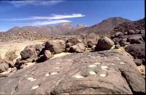
Reibmulden adjacent to handal furnace
Two times (on our way to Gebel Ohair and on our way back to Atbara) we went to the bedouin market at Ariab goldmine (see position of “souk” on map) for replenishing our supplies. Ariab Mining Company (AMC), which operates several mines in the region, is a french-sudanese business venture and employs around 2.000 workers. Gold is recoverd from quartz minerals by cyanide leaching. Each week tons of poisonous waste are filled in plastic containers and burried somewhere in the ground. Such practises may lead to enviromental desasters in future.
The large scale mining operations at Ariab contrast sharply with the artisan workings of the locals. While modern technology and return-on-investment necessities require the extermination of whole mountains and the demolition of mountain ranges, the gold workings of the traditional type leave but a scratch in the landscape. Karar and his fellow (Bisharin) countrymen are strongly attached to their ancestral lands. So far, the Bisharin have resisted pressures, to let AMC mine their territory. How long will such opposition be sustained? Because of the draught the Bisharin are being marginalized and their region is left to poverty and neglect.
Ariab goldmines operate on Atmaan territory. They are guarded by Sudanese military. When we arrived at Ariab on our return to Atbara, the armed forces had withdrawn to Port Sudan, where, on 1/29/2005, members of the Beja tribe had gathered for a demonstration demanding negotiations on a power-sharing agreement and on an arrangement to share their country´s resources. At least 18 persons were shot dead. Because of these events and of the power-vacuum around Ariab a tight atmosphere prevailed on the souk. That the camels and I returned safely from the expedition is owed to Karar – to his caution and determination. The evening before we reached Atbara my companion exclaimed: “Praise be to Allah that once more we see the Nile!” Proceeding his exclamations, he thanked his God, that I had survived and not been murdered by some heartless character (“someone with an impure heart”, as he said). To make sure, that, after our adventure, he would arrive as a proud man at his family, I gave him Amur II. as a present.
finis
Carlo Bergmann, 8/31/2005